Showing posts with label Utah County Hikes. Show all posts

Thursday, June 6, 2013

Scout Falls Hike

Scout Falls from the trail
Scout Falls is a beautiful hike located along the Timpanooeke route to Timpanogos Peak. 
It is a nice easy trail. The first half is relatively flat and the last half is a bit steeper, but very doable. 

First half of the trail
Trail begins to get steep at the first glimpse of the falls
 From the parking lot you need to find the trail. We thought this would be easy, but as we passed the restrooms and headed up the trail there were 3 different trails and no sign to Scout Falls. There is a trail to the left, a trail up the mountain in the middle and a trail to the right. Take the trail in the middle near the ranger house and the sign with the map. It is the same trail you would use to hike Timp. Continue along this trail until you come to the second spur in the trail. The first spur is found about .6 miles and looks like it would take you to the run-off of the falls. This is not the correct spur. Continue on the trail about 1.4 miles total and find the second spur. This one is well-worn and heads out to a beautiful view of the falls. 
What a beautiful bowl


Scout Falls
Don't plan on getting in. There really isn't a suitable place to get in without risking a getting injured. These falls are best suited for viewing:) There are several rocks and places towards the end of the hike to sit and eat a snack or lunch.

View from scout falls
Getting there is fairly straight forward. Head up American Fork Canyon or up Provo Canyon to Sundance (remember there is a pay station) about 8 miles to the Timpanooeke Campground. Turn into the campground and continue up the road past the campground. You will come to the Timpanooeke Trailhead parking lot. Here you will find ample parking and restroom facilities. The trail begins to the right of the restrooms.

This is a good hike for families.
Happy hiking!

Friday, May 31, 2013

Big Springs Hollow Hike

This hike was a nice easy family hike. It is located up Provo canyon. To get there, head east up the canyon. Turn right at Vivian Park and continue up South Fork about 3 miles. When you see the National Forest Area sign on the left side of the road turn right into the parking lot and continue to the end where you can park. The trailhead is in the Southwest corner of the park.
It is a very mild hike that is about 3.4 miles round trip. It was beautiful. There is a slightly steeper section towards the end of the hike as you approach the springs, but that only lasts about 0.2 miles.
The trail continues past the springs and some of our group didn't realize so they continued on. You can make the hike as long as you want.

This is very pretty in the spring and full of green. Spectacular views of the snow covered mountain peak above the meadows.


Sunday, May 12, 2013

Fifth Water Hot Springs Hike

With spring officially here it is once again time to get the family out and explore new hikes and fun places to go. We started our hiking season out by going to the Spanish Fork hot springs we have heard about, but never visited. 


Directions: They are located up Spanish Fork Canyon. Follow Highway 6 until you come to a sign for Diamond Fork campground. Turn left here and follow the road until you come to Three Forks. Turn right into the parking lot. There is a toilet at the trail head. The trail head is to the right of the toilets. Follow the trail staying on the left side of the river...do not cross the first bridge. Cross at the second bridge. As you get close you will be able to smell the sulfur. 

There are lower and upper pots. We spent most of our time in the lower pots. There are about 5 pots in the lower area. Some are more private only holding a handful of people and there is one big one as well. There are 2 more that we saw at the upper pots. There is a nice little waterfall that the older kids went behind and stuck their heads out of.
The men decided to take the kids up to the upper pots and were surprised to find a man skinny dipping on a Saturday morning at a family destination...um, :) just be aware...and for those of you wanting to skinny dip, it is against the law I am told.
The hike is 2.5 miles each way 5 miles round trip. I would classify it as an easy to moderate hike depending on your level of fitness. It is a gorgeous hike that follows the river up the canyon. It has a little incline that is very doable, in fact an energetic 3 year old made the trip with us. We went with another family and had two 13 year olds, an 11 year old, a 10 year old, two 7 year olds, a 3 year old and a 9 month old plus a dog...yes, dogs are allowed on this hike. Our hike time was 58 minutes on the way there. We took our snacks and lunch and ate up at the top. 

This is a busy destination for families and groups. We passed several scout groups hiking out and many families coming and going. Please be respectful and don't leave anything behind so we can all continue to enjoy this beautiful place...and please keep your clothes on:)

Sunday, August 19, 2012

Alpine Natural Water Slide Hike

My friend called me to go find the natural water slide in Alpine, Utah. It is something I had read about and wanted to take our hiking group to. Sadly we never did make it there. So we loaded up the kids and headed out in search of an adventure. And an adventure is what we got.

Getting there was our first adventure. My friend looked up directions before we headed out. We got somewhat confused and took a right turn where we should have gone straight. This one mistake led to at least an hour of searching, hiking, hot and hungry kids and bewilderment. We finally determined where we had made our mistake and headed up the road to the correct trail.

Once there, the kids had a ball. My 6 year old went down the slide and came out crying. When I asked if he was hurt, "no" was the answer, when I asked why he was crying, "it is just so cold". I told him he did not need to go again and his reply, "It was fun, I want to...(between tears) I just need to get warm first".

The water slide is made of a large, smooth granite slab in the river. It is about 25 feet of slide. The water is freezing cold and the hike up is a bit slippery, especially with chaco's on.

To get there, take I-15 to the Alpine/Highland Exit and head 5 miles east towards American Fork Canyon.  Turn left at the stop light in Highland (near the grocery store and gas station). Drive on this road a few miles. You will come to a round about. Continue on the same road through the round about. When you come to Fort Canyon Road you will turn left and follow that road until you come to a gated off road with a large No Trespassing sign. Park anywhere along this road. Go through the No Trespassing gate and stay on the road for about a mile.


You will pass a right turn... continue straight. You will come to two forks in the road...always stay to the right. When you finally come to a large yellow metal thing on the east side of the road, there is a small parking lot. Continue through the parking lot to the dirt road on the other side. Off to the left of the dirt road is a trail that heads through the trees and ends at the waterfall in about 100 feet or so.

And have fun!!


Thursday, June 28, 2012

Maple Canyon Equestrian Trail Hike


Maple Canyon has a nice 1-mile (each way) hike that is fantastic for small children and easy for adults as well. It is located in Mapleton, Utah and is a very 
beautiful trail that winds next to the road although you never see the road. It is nice 
and cool due to all the shade. I find this particular trail very beautiful in the fall when the 
leaves begin to change color. It is also a wonderful trail to run if you enjoy trail running. 
It is also open to mountain biking. (With it being such a short trail it is best for beginners, 
children age 8-10 and up, those making loops or those who want to continue on up through 
the campground to the trail at the top of the parking lot for more challenge).

To get there:
From I-15, take Springville exit 260. Head east 2 miles to the intersection of Main Street and
400 South. Turn right on Main Street, staying in the right lane toward Highway 89/Price.
Continue 2.3 miles to Maple Street. Turn left on Maple Street/State Highway 147 for .9 miles
to Main Street in Mapleton. Turn left on Main Street, then right on 400 North. Drive east on
400 North until you come to the canyon. After passing through the open gate you will drive
up a hill and after the hill there is a parking lot on the right hand side of the road. Pull in and
park. The trailhead is on the east side
of the parking lot. 

This is where those bringing horses into the canyon must park. The sign says equestrian trail
 parking I believe. 

The trail will end up at one of the campground parking lots. This is an out-n-back trail and is
easy enough to start the littlest of hikers :) If you choose to take the trail on the west side of the
parking lot, the bonneville shoreline, it ends where a property owner has put up a huge fence
and you will be considered trespassing. So stick to the east trail.

Go in a group in this canyon as occasionally we hear of weird people or experiences. There
has never been trouble when you are with a buddy. It is always important to never go 
alone wherever you find yourself.

Happy Hiking!

Wednesday, June 27, 2012

Maple Canyon Hike

Maple Canyon is a beautiful little canyon located in Mapleton, Utah. The trailhead begins above Whiting campground.

From I-15, take Springville exit 260. Head east 2 miles to the intersection of Main Street and 400 South. Turn right on Main Street, staying in the right lane toward Highway 89/Price. Continue 2.3 miles to Maple Street. Turn left on Maple Street/State Highway 147 for .9 miles to Main Street in Mapleton. Turn left on Main Street, then right on 400 North. Drive east on 400 North for 2.7 miles to the campground. Continue on the road as it winds through the campground to the parking lot. The trailhead is at the far end of the parking lot and is marked with a sign.


This trail allow dogs and horses. It is quite shady so it works well on a hot day. Stay on the main trail. There is no destination here, but kids love it and there are many places to stop and have your lunch on a log or in a small clearing. You can go as far as you want to before turning around.

This trail is open to horses, motorcycles and mountain bikes. We trail run this trail sometimes.


This is the trail marker to go to Spanish Fork Peak. It is found across the river on the right side of the trail. It is 5 miles to hike up to the peak. We stayed on the main trail for today and will do the peak another day.


Happy Hiking!


Tuesday, June 26, 2012

I Love Utah! Gorgeous!


This is why I love living in Utah. 
No explanation needed :)


This hike is located up the left fork of Hobble Creek Canyon in an area known as Whitemore. To access it, you have to know the land owners as it starts on private property...so we happen to be lucky enough to be friends with them. 
It is roughly a mile or so to the first lake. If we would have gone on, there are 4 more lakes beyond this one. The lakes are accessible from the other side of the mountain.


Stewart Falls Hike

Yesterday I took the kids and those in my hiking group to Stewart Falls. Our hiking group consists of mothers and children...and occasionally our husbands:) I started this group to help others who want to get out and hike but don't know where to go, who may be scared to go alone or who may not have enough experience to do it on their own with children. It has been fun so far. Take a look at what we saw:
Stewart Falls is located up Provo Canyon above Sundance Ski Resort. To get to Provo Canyon, from I-15 take the 800 North exit in Orem and drive East until you get to the mouth of the canyon. Drive 9 miles up the canyon to the Sundance turn-off. Turn left and drive up the canyon past Sundance and Aspen Grove until you come to the pay booth. (Remember that this canyon has a $6 per day use fee or you can use/purchase a National Parks Pass which is $80 for the year). After the pay booth pull into the first parking lot on the left side of the road. There are 2 trailheads leaving from this parking lot. To access Stewart Falls you need to be on the trail that leaves near the bathroom and be sure you stay to the left...do not go on any of the spur/side trails as this will take you up Mt. Timpanogos.

 The trail is approximately 2 miles one way...4 miles round trip. I love this trail because it isn't too difficult for my children and the first half of the hike is in the shade of the trees.

The first time I did this hike carrying my child in a baby backpack was more difficult...just FYI. Along the way we saw a tree that had been marked by a bear and the kids thought that was great. There are several geocaches hidden along the way.


Stay with your children as you get towards the end of the trail. There is an outcropping of rocks towards the end that my friends boys and my youngest decided to climb...as they were a bit ahead of us. The other side is a drop-off of about 40 feet. As you reach the outcropping, the trail continues down to the left to the waterfall where the kids can cool off.

This is a great family hike.

My son had a self-carved walking stick and hand-carved whistle that we set down while we were in the water...someone walked off with them. He was so upset because of the time it took for him to make it. We like to assume that the person didn't know or didn't see his name engraved on the stick....just putting it out there because you never know if someone may find it:)

Happy Hiking!

Tuesday, June 5, 2012

Red Lake Hike Nebo Loop


Payson Canyon boasts many hiking trails. One of these hikes is the Red Lake Hike. This hike is 1.75 miles one way and is an incline the majority of the way. My son, age 5, completed the hike by himself. He was very tired by the time we reached the lake. The lake is nestled up in the mountains and we were able to find a couple of places to camp around the lake. Be sure to take plenty of water, snacks and sunscreen.


The trail begins on a nice trail that winds through the maple trees. After descending a bit and crossing a river with the strategically placed plank, the trail once again inclines. You will soon notice where the pipeline was laid into place. Follow it to the right until the trail becomes visible again on the left. You will know you are on the right track if you pass the remains of an old car. The trail continues on through aspens and conifers and eventually to red lake.

The Stats:
sits at 6972 feet
3.5 miles round trip
GPS coordinates:
Degrees Minutes Seconds:
Latitude: 39-56'44'' N
Longitude: 111-42'30'' W
Decimal Degrees:
Latitude: 39.9455111
Longitude: -111.7082613


To Get There: get off I-15 at Payson Exit 254, turn south onto Payson Main Street (State Route 77). Continue south until Main Street meets 100 North. Turn left and travel east to 600 East, then turn right, and follow this road south to the entrance to Payson Canyon and the beginning of the Nebo Scenic Loop. Continue up the canyon turning off at Maple Bench and drive past the campground. Take the first left on the gravel road and park near the restrooms. The trail skirts the fence.

Sunday, June 3, 2012

The Grotto Hike

Day 6 of Summer Fun -
Gorgeous Falls with easy access
The Grotto is the next stop for us on our  
Summer Fun Family Tour. 
The grotto is a short hike in Payson canyon that is only .6 miles long and ends at a waterfall with an area for the kids to play in. In Springtime, the runoff will be higher than in the fall. Visiting the Grotto with children after a particularly wet winter would be wisest in the fall months when the runoff is lower. Where we had a low amount of moisture this past winter we are going in late spring.

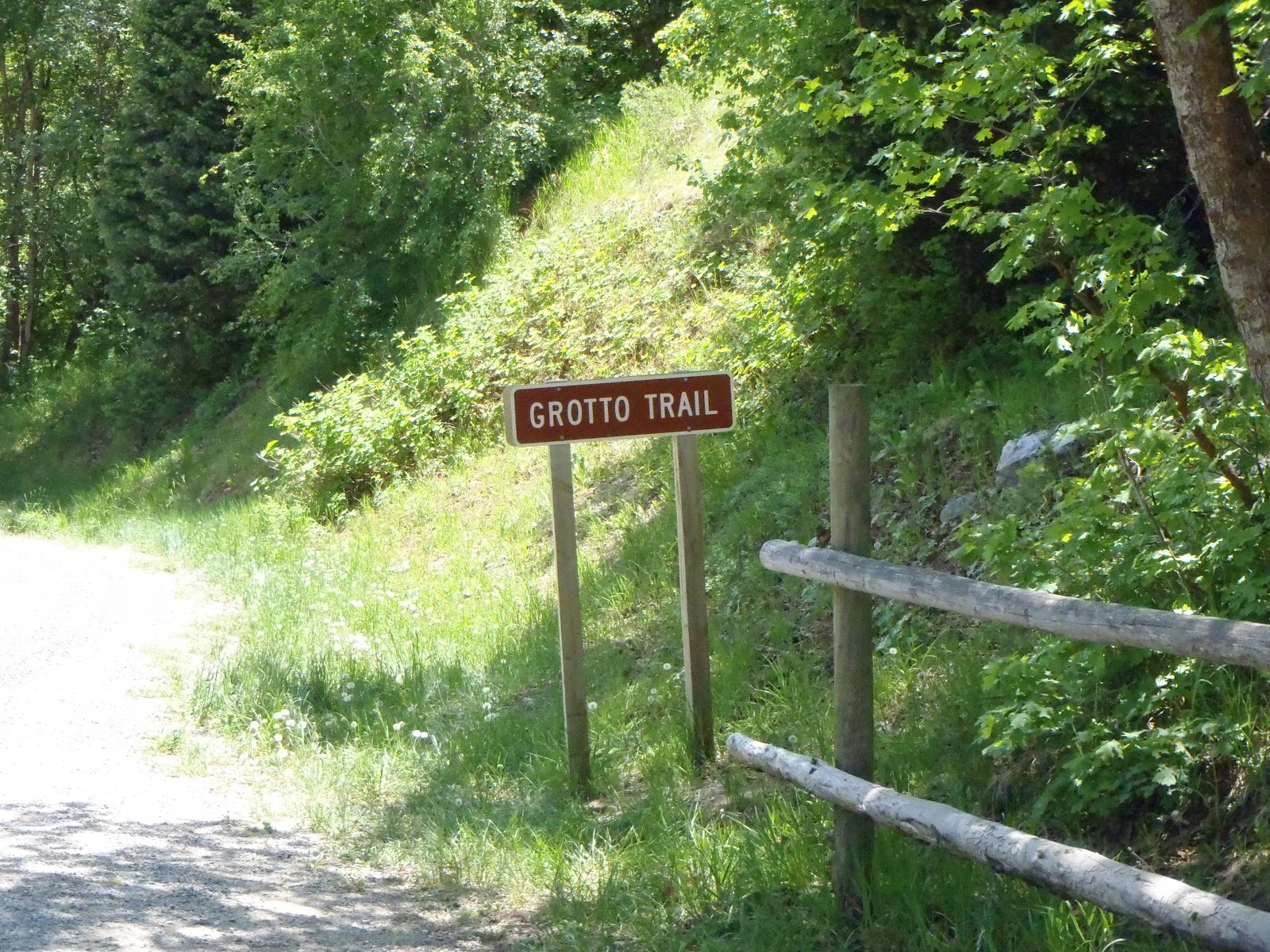
Trail sign off the side of the road
The trail head starts here
A 2 year old hiked to the Grotto

Logs to navigate around the water
To reach the Grotto Trail: get off I-15 at Payson Exit 254, turn south onto Payson Main Street (State Route 77). Continue south until Main Street meets 100 North. Turn left and travel east to 600 East, then turn right, and follow this road south to the entrance to Payson Canyon and the beginning of the Nebo Scenic Loop. The trailhead is roughly 7 miles up on the left side of the road. Be cautious as this is a popular bicycle canyon.

Remember to Share the Road :)


Bring the kids swimming suits and shoes they can get wet. The kids will love this adventure and have a great time playing in the water. Plan on at least 45 minutes or longer if the kids want to play more.

Timpanogos Cave Hike

Day 5 of Summer Fun  -

After having a work day on Thursday my husband took the kids to visit Timpanogos Cave in American Fork Canyon the next day. If you have never been there before here are driving directions:

From I-15: If you are arriving from the north or south on Interstate 15 take Exit 284 (Alpine-Highland exit), then turn east on State Highway 92 and proceed ten miles (16km) to the monument.

From U.S. 40 or U.S. 189: If you are arriving from Heber City or Provo Canyon traveling on U.S. 40 or U.S. 189, take State Highway 92, passing by Sundance Resort and over the mountainous scenic route known as the Alpine Scenic Loop. Because of the narrow and winding road, buses and large vehicles over thirty feet are not allowed to travel on the Alpine Scenic Loop. The Alpine Scenic Loop is closed during the winter.

Hints for visiting the cave:
1. Call ahead to get your tickets. They are 50 cents more expensive to call, but it is worth making sure you will have tickets when you arrive. The cave is often times sold out. To purchase advance cave tour tickets, call (801) 756-5238 during the hours of 8:00 AM to 5:00 PM. Please remember that anyone under 16 years of age must be accompanied by an adult.
Cave Tour Fees
Adults (age 16 and older) - $7.00
Junior (age 6-15)             - $5.00
Child  (age 3-5)               - $3.00
Infant (age 0-2)               - Free!
Senior/Access (Golden Age/Access) pass holders - 1/2 price


2. Bring plenty of water. The hike is 1 1/2 miles on a paved trail. It is a steep trail and gets very hot. Take more water than you would normally think necessary. My kids do the very best when they have their own camelback or hydration system that they carry with them. Our packs have a spot for snacks as well.

3. Strollers and wheelchairs are not allowed on the trail due to the steepness.

4. Backpacks must be left outside the cave when going on the tour. If you have a child carrier, that must be left outside and you will have to carry the child through the cave.

5. Cave tours are 45-60 minutes long.

6. There is a $6 fee for entering the canyon or you can buy a year long pass that gets you into all the national parks.  The yearly pass is $80. 

7. It may get chilly inside the cave so a light jacket or sweatshirt may be needed. It is about 45 degrees inside the cave.

This is a fun experience that the kids loved. The caves are cool and feel great after the hot hike up the trail. The rangers show you all sorts of different formations and neat rooms in the cave. This is an experience not to be missed.
The trail itself has drop-offs that are potentially life threatening so be sure to keep your little ones with you and away from the edge at all times.

Monday, May 28, 2012

Tibble Fork Loop Trail


Day 1 of Summer Fun


As summer begins my husband and I decided to offer up a family summer challenge. If, as a family, we can hike at least 100 miles this summer then we will take the kids to do something special of their choosing. The boys decided that sounded like a good idea so here we go. Wish us luck!

We took our kids and some friends on a new hike up American Fork Canyon near Tibble Fork Reservoir. The hike is called Tibble Fork Loop Trail. I read reviews of the trail and it seemed like a good one for the family. Here are our stats taken from our GPS.


The stats:
4.5 miles
1000 foot elevation gain
3 hours

To access the trail you go to American Fork Canyon by taking exit 284 the Timpanogos Highway exit and following the road east to the canyon. From the toll booth (plan on paying $6 or buying a year pass to get into the canyon) drive until you see the Tibble Fork Reservoir sign. Turn left and follow the road until you come to the parking lot.

taken on the dam looking south
taken on the dam looking north
our hiking group today

The trailhead is located on the east side of the dam. Park and walk across the dam. Plan on the first mile of the hike being somewhat steep. If it has rained in the previous couple of days, I suggest you choose a different trail to hike. We hiked up in the mud. The kids loved it and it made for a memorable hike, but it was slippery and made the hike more difficult.


When you reach the first meadow be sure to turn around and look back down the trail. The view is stunning. The snow covered mountains tower over the aspens and pines. A 10 year old boy in our group managed to catch a snake near the small stream running through the meadow.


When you come to the junction in the trail with a sign for Mill Canyon hang a left. A man on a horse told us that there is a resident BIG black bear that often times is in this area so keep your eyes open. He saw it not more than 2 weeks prior to our hike standing in the middle of the trail.

Geo-caching Fun!
Take your next 2 left forks and then stay on the trail. If you enjoy geo-caching plan ahead. We found a geo-cache right off the trail. Remember that if you find a cache you can take something if you have
something to leave. This photo is of our group finding the cache. This is always so exciting for the kids!

Follow the trail and it will lead you to a bridge that crosses the river and puts you out on the road North of the dam. Follow the road back to your car. This was a fun hike. Be aware that this trail is open for equestrian use as well as motorcycle use. We saw plenty of both being Memorial Day Weekend.